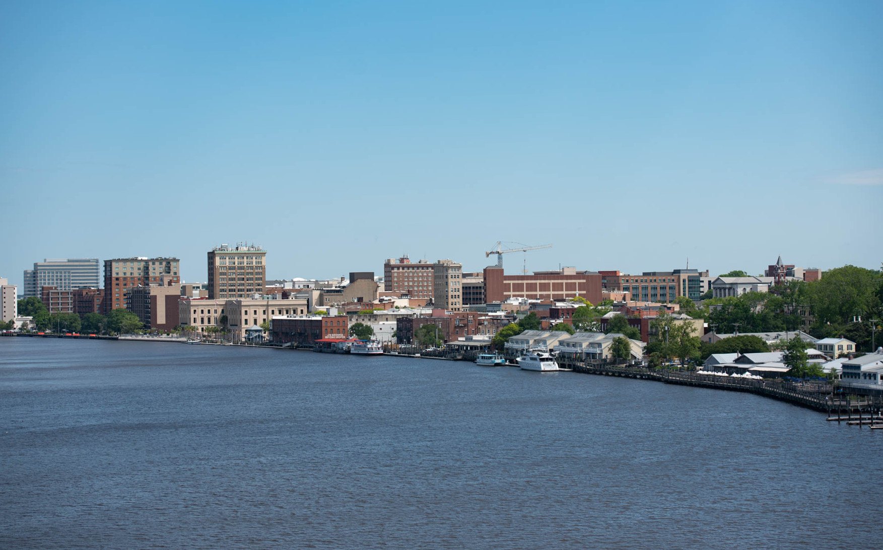
Wilmington’s downtown waterfront on the Cape Fear River

Outdoors

Fishing near Wilmington

Lakes, rivers and recreation areas near Wilmington where fishing is allowed, closest first.

18places to fish
21 mito the closest
1within 30 miles

Good to know: Anyone 16 or older generally needs a state fishing license; seasons, limits and special rules vary by water. North Carolina license information ↗

Closest picks

1

Moores Creek National Battlefield

21 mi northwest · National Park Service

In the early morning hours of February 27, 1776, Loyalist forces charged across a partially dismantled Moores Creek Bridge. Beyond the bridge, nearly 1,000 North Carolina Patriots waited quietly with cannons and muskets poised to fire.

2

Cape Fear River

49 mi northwest · US Army Corps of Engineers

Located in the tobacco country of eastern North Carolina on the improved channel between Wilmington and Fayetteville, the facilities are equipped for day-use, boating and picnicking.

3

Cedar Point Campground

57 mi northeast · USDA Forest Service

Cedar Point Campground and Recreation Area is located in eastern North Carolina at the junction of the White Oak River and the Bogue Sound, immediately adjacent to the Swansboro Inlet.

Map of all 18 places

Map of 18 places loads as you scroll.

Within 30 miles (1)

21 mi northwest · National Park Service

Moores Creek National Battlefield

In the early morning hours of February 27, 1776, Loyalist forces charged across a partially dismantled Moores Creek Bridge. Beyond the bridge, nearly 1,000 North Carolina Patriots waited quietly with cannons and muskets poised to fire.

  • Fishing
  • History

30 to 75 miles (3)

49 mi northwest · US Army Corps of Engineers

Cape Fear River

Located in the tobacco country of eastern North Carolina on the improved channel between Wilmington and Fayetteville, the facilities are equipped for day-use, boating and picnicking.

  • Boating
  • Fishing
  • Hiking
  • Picnicking
  • Water sports
  • Wildlife viewing

57 mi northeast · USDA Forest Service · Campground

Cedar Point Campground

Cedar Point Campground and Recreation Area is located in eastern North Carolina at the junction of the White Oak River and the Bogue Sound, immediately adjacent to the Swansboro Inlet.

  • Boating
  • Camping
  • Fishing
  • Hiking
  • History
  • Water sports

75 mi northeast · USDA Forest Service · Campground

Oyster Point Campground

Oyster Point Campground is located on the banks of the Newport River, near the town of Newport, NC. The campground is just a short drive to the beaches of Atlantic Beach, NC and other coastal fishing destinations.

  • Boating
  • Camping
  • Fishing
  • Hiking

75 miles and farther (14)

83 mi southwest · Fish and Wildlife Service

Waccamaw National Wildlife Refuge

Waccamaw National Wildlife Refuge was established on December 1, 1997 and consists of wetland habitats ranging from historic, broken and actively managed tidal rice fields, to black water and alluvial flood plain forested wetlands of the…

  • Fishing
  • Hunting

92 mi northeast · National Park Service · Campground

Great Island Cabin Camp

Great Island Cabin Camp sits on South Core Banks within Cape Lookout National Seashore, just off the North Carolina coast. This historic, remote camp has long been a favorite destination for fishermen and beachgoers.

  • Beach
  • Beach Camping
  • Boating
  • Camping
  • Clam Digging
  • Crabbing
  • Fire Lookouts/Cabins Overnight
  • Fishing

104 mi northeast · National Park Service · Campground

Long Point Cabin Camp

Escape to North Core Cabin Camp — a one-of-a-kind coastal getaway on North Core Banks within the stunning Cape Lookout National Seashore.

  • Beach
  • Beach Camping
  • Birding
  • Boating
  • Camping
  • Canoeing
  • Fishing
  • Hiking

105 mi northeast · Fish and Wildlife Service

Cedar Island National Wildlife Refuge

Cedar Island National Wildlife Refuge, located in Carteret County, North Carolina is on the end of a peninsula marking the southern end of Pamlico Sound.

  • Biking
  • Birding
  • Boating
  • Fishing
  • Hiking
  • Hunting
  • Motor Boat
  • Non-Motorized Boating

120 mi northwest · US Army Corps of Engineers

B. Everett Jordan Lake

B. E. Jordan Dam and Lake is located near the center of North Carolina with a large population base in a 75-mile radius of the project.

  • Boating
  • Camping
  • Fishing
  • Hiking
  • Nature education
  • Picnicking
  • Water sports
  • Wildlife viewing

120 mi northeast · Fish and Wildlife Service

Swanquarter National Wildlife Refuge

Swanquarter National Wildlife Refuge is an extensive coastal marsh which includes the Swanquarter National Wilderness Area.

  • Biking
  • Birding
  • Boating
  • Fishing
  • Hiking
  • Hunting
  • Motor Boat
  • Non-Motorized Boating

126 mi southwest · USDA Forest Service · Campground

Buck Hall Recreation Area

Buck Hall Recreation Area offers a premier location to enjoy the outdoors. It is situated along the Intracoastal Waterway and provides great access to Cape Romain National Wildlife Refuge, 65,000 acres of marsh, tidal creeks and beaches;…

  • Biking
  • Boating
  • Camping
  • Fishing
  • Hiking
  • Wildlife viewing

126 mi north · US Army Corps of Engineers

Falls Lake

The US Army Corps of Engineers and the State of North Carolina would like to welcome you to Falls Lake.

  • Biking
  • Boating
  • Camping
  • Fishing
  • Hiking
  • Hotel/Lodge/Resort Privately Owned
  • Nature education
  • Picnicking

128 mi northeast · National Park Service · Campground

Ocracoke Campground

Located in the famous Outer Banks area of the stunning North Carolina coast, this campground is perfect for a beach getaway trip. Recreation The seashore provides a place for active recreation or for quiet reflection.

  • Boating
  • Camping
  • Fishing
  • Swimming

129 mi northeast · Fish and Wildlife Service

Mattamuskeet National Wildlife Refuge

In the early 20th century, farmers and developers attempted to drain Lake Mattamuskeet, building what was at the time the world’s largest pumping plant. The lake was drained several times to convert the lake bottom to farmland.

  • Birding
  • Boating
  • Educational Programs
  • Fishing
  • Hiking
  • Hunting
  • Motor Boat
  • Nature education

132 mi northeast · National Park Service · Campground

Cape Point Campground

Cape Point Campground sites have a shortened reservation window. Due to the ground saturation and potential for flooding we encourage you to check the sites prior to paying.

  • Camping
  • Fishing
  • Hiking

134 mi southwest · Fish and Wildlife Service

Cape Romain National Wildlife Refuge

Established in 1932 as a migratory bird refuge, the refuge's original objectives were to conserve in public ownership habitat for waterfowl, shorebirds and seabirds, and resident species.

  • Beach
  • Birding
  • Boating
  • Fishing
  • Hiking
  • Hunting
  • Non-Motorized Boating
  • Photography

134 mi northeast · Fish and Wildlife Service

Roanoke River National Wildlife Refuge

Roanoke River NWR was established in 1989 to protect and enhance wooded wetlands consisting of bottomland hardwoods and swamps with high waterfowl value along the Roanoke River.

  • Archery
  • Birding
  • Boating
  • Educational Programs
  • Fishing
  • Hiking
  • Hunting
  • Motor Boat

135 mi west · Fish and Wildlife Service

Carolina Sandhills National Wildlife Refuge

The refuge was established on March 17, 1939 to provide habitat for migratory birds, to demonstrate sound management practices that enhance natural resource conservation, and to provide wildlife-oriented recreation opportunities.

  • Biking
  • Birding
  • Boating
  • Fishing
  • Hiking
  • Hunting
  • Observation Site
  • Paddling

Distances are straight-line miles from downtown Wilmington. Listings come from Recreation.gov’s federal recreation database; check each official page for hours, fees, fire restrictions and closures before you go.

Get outside around Wilmington

Downtown Wilmington North Carolina Walking Tour - City Walks - Treadmill Walking Scenery - 4k video thumbnail

A WALK AROUND TOWN

Downtown Wilmington North Carolina Walking Tour - City Walks - Treadmill Walking Scenery - 4k

Downtown Wilmington North Carolina Walking Tour - City Walks - Treadmill Walking Scenery - 4k. A film shared by City Walks.

Watch on YouTube ↗

More outdoors near Wilmington

Questions

Where is the closest place for fishing near Wilmington?

Moores Creek National Battlefield (National Park Service), about 21 miles northwest of Wilmington as the crow flies. Next are Cape Fear River (49 mi) and Cedar Point Campground (57 mi).

Do I need a fishing license near Wilmington?

Yes, anglers 16 and older generally need a North Carolina fishing license from the state wildlife agency. Rules, seasons and limits vary by water.

Who manages these places?

Federal agencies including Fish and Wildlife Service, National Park Service, US Army Corps of Engineers. Each listing links to its official page for hours, fees, closures and current conditions.

Wilmington AI

Your Wilmington local guide
Hey there!

I'm Wilmington AI. Ask about neighborhood food, independent shops, local history or planning a visit.

AI recommendations may be inaccurate. Verify hours and prices. Questions are processed by Cloudflare. Privacy